On this page
Tasman Sights
Lavender, Dog Line, cave
- Length8 hours
- Leaves9:30 AM
- IncludesHarbour cruise
Choose your stop
Port Arthur Tasman Sights with Harbour Cruise
★ 4.8 · From 455 reviews
Browse 23 stops
Start by picking a route; tap a pin or stop for its note and Google Maps.
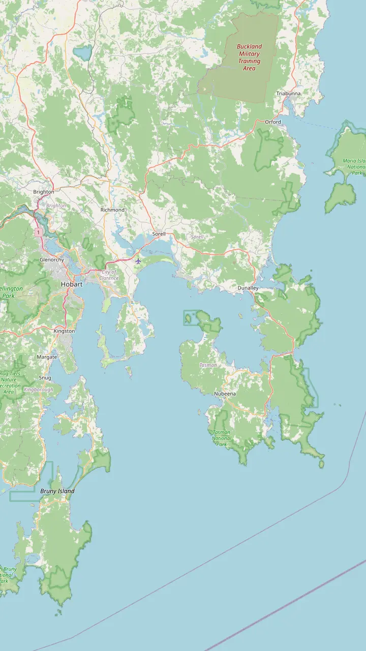
Leave Hobart on the Tasman Highway (A3) over the Tasman Bridge; Tassielink route 734 starts in Elizabeth Street.
Google MapsSorell lies 27 km from Hobart; here the signs send you onto the Arthur Highway (A9).
Google MapsDunalley is 30 km past Sorell; cross the canal bridge and the turn-off to the site comes 44 km later.
Google MapsEaglehawk Neck has the Dog Line sculpture and the Officers' Quarters of 1832.
Google MapsNubeena is where the Tassielink route to Hobart now begins, travelling via Port Arthur.
Google MapsThe historic site opens daily from 9:00am to 5:00pm and is closed on Christmas Day.
Google Maps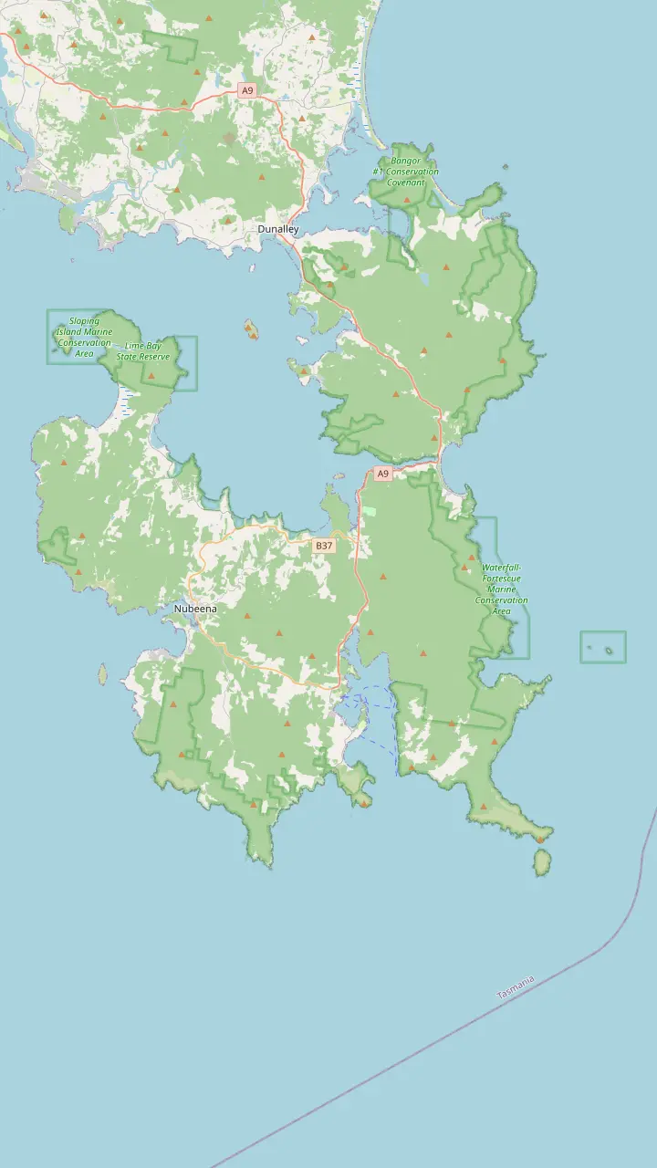
The Tessellated Pavement is best seen at low tide.
Google MapsThe Blowhole is reached by a wide loop track with a few stairs.
Google MapsDevils Kitchen and Tasmans Arch share a 600m sealed circuit of 20 minutes.
Google MapsDoo Town's shacks carry playful Doo names, a habit begun in 1935.
Google MapsThe Tasmanian Devil Unzoo opens every day at 9 am.
Google MapsPort Arthur Lavender sits at 6555 Arthur Highway, above Long Bay.
Google MapsRemarkable Cave is 115 steps down from its car park.
Google MapsThe Coal Mines Historic Site is free to enter.
Google MapsFortescue Bay is 12km of unsealed road off the highway and the start of the Cape Hauy walk.
Google Maps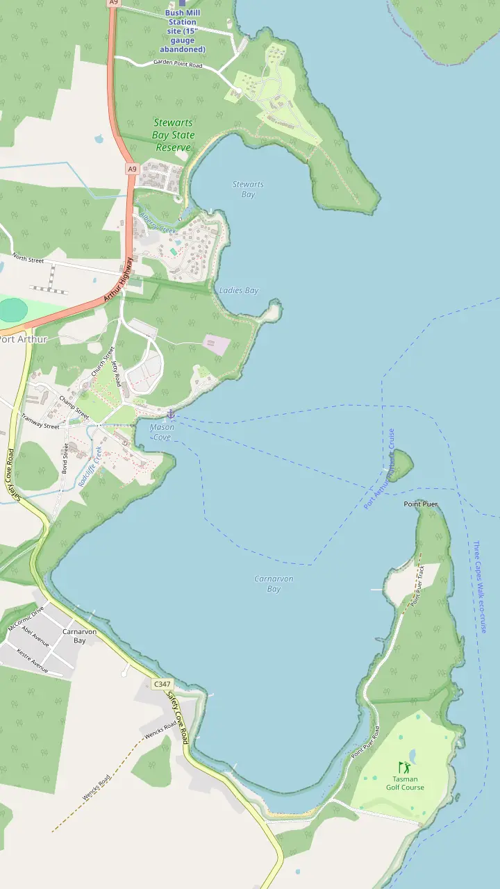
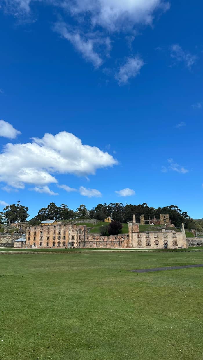
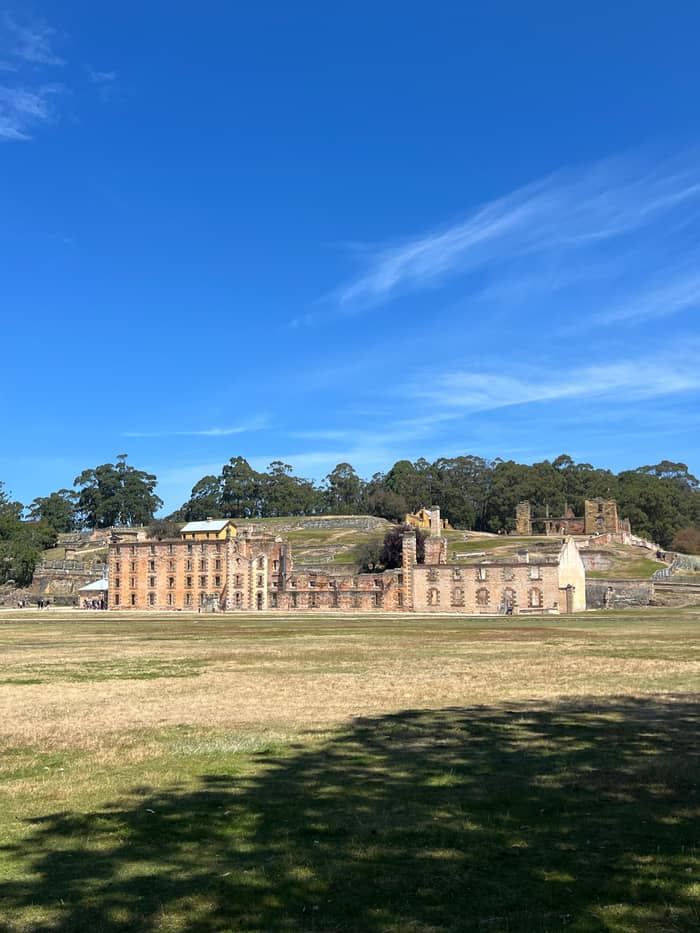
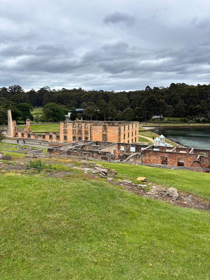
The Penitentiary began as a flour mill and granary and was turned into a prison between 1854 and 1857.
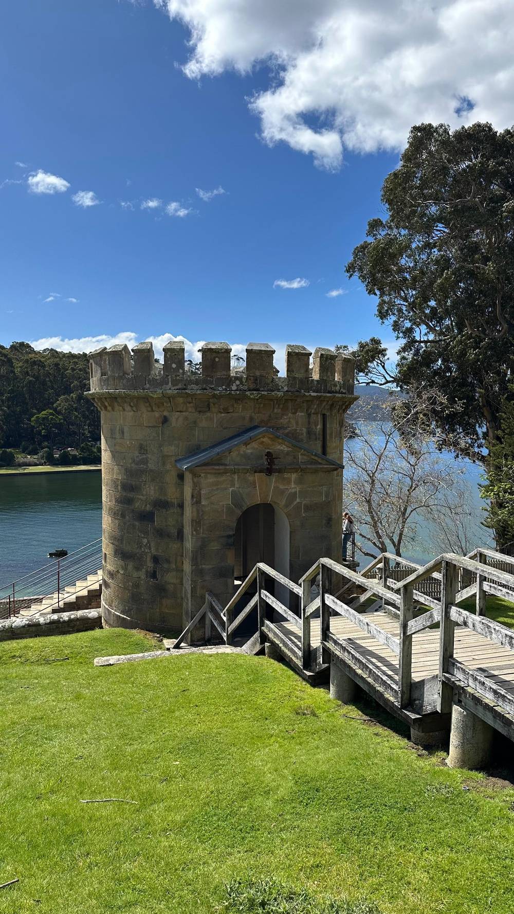
Google MapsThe Guard Tower is one of the convict-era ruins inside the historic site.
Google MapsThe Commandant's House is one of the site's furnished museum houses.
Google MapsThe Convict Church stands without a roof, and its bells ring every hour.
Google MapsThe Asylum, begun in 1864, now houses the quieter cafe.
Google MapsThe Memorial Garden is a quiet place of remembrance near the Visitor Centre.
Google MapsThe Isle of the Dead holds more than 1,000 burials from 1833 to 1877.
Google MapsPoint Puer was the British Empire's first institution built to reform convict boys.
Google MapsMap © OpenStreetMap contributors
The convict site is only the start. Around Port Arthur the Tasman Peninsula has sea arches, a blowhole, a sea cave, a devil sanctuary, a lavender farm and some of the highest sea cliffs in Australia.
Editorial team, portarthurtour.quest · Updated November 8, 2026 · ~8 min read
Facts at a glance
The convict ruins are the headline, but the list of things to do in Port Arthur runs well beyond the historic site. Much of the peninsula's coast lies in Tasman National Park, whose sea cliffs are Australia's highest.1 Discover Tasmania goes further and calls them the Southern Hemisphere's tallest, rising to 300m on the Three Capes Track.7,8 The peninsula also holds two of Australia's 11 World Heritage-listed convict sites.9
Plan around one rule. A valid parks pass is required to enter Tasmania's national parks, and that covers Tasmans Arch, Devils Kitchen, Remarkable Cave and the cape walks.5,2 The Officers' Quarters at Eaglehawk Neck sit outside the park and need no pass.6 Buy the pass before you set out, so that each stop at the arch, the blowhole or the cave is simply a matter of parking and walking.
The sights cluster in two places. The northern group sits around Eaglehawk Neck, about 20km north of the historic site, and the southern group sits just past Port Arthur township on Safety Cove Road.10,11 Between them, on or near the Arthur Highway, are the devil sanctuary and the lavender farm.12 One long day covers the highlights, and a second day lets you add a cape walk. Fuel up before you start, because most peninsula fuel stops are shut by 6:00pm.13
Sights compared
| Sight | Time | Parks pass | Access |
|---|---|---|---|
| Tasmans Arch and Devils Kitchen | 20 minutes | Yes | Sealed, all abilities |
| Tasman Blowhole | Short loop | Yes | Some stairs |
| Remarkable Cave | 115 steps | Yes | Lookout accessible |
| Officers' Quarters | Short stop | No | Parking in front |
| Coal Mines | 1-2hr | No ticket | Walking trail |
Times and access from the parks service and Discover Tasmania; a parks pass is needed in the national park but not at the Officers' Quarters or the Coal Mines.2,17,21,6,35,4
Eaglehawk Neck is where the peninsula almost becomes an island: Discover Tasmania puts the isthmus at less than 100m wide at one point.10 In convict times it was crucial to the security of the prison settlement.22 A sculpture now stands where the Dog Line once ran, a row of savage dogs chained across the whole width of the Neck to stop runaways.15,23 The Neck links the Tasman Peninsula to the Forestier Peninsula, the road you drive in on.22
Beside it stand the Officers' Quarters of 1832, thought to be Australia's oldest surviving military building.16 The station there closed in 1877, and the government bought the site in 1991.24 The parks service tells the story of the bushranger Martin Cash, who got past the dogs by detouring out to sea.25 The Officers' Quarters belonged to a small military settlement that also had a barracks, a guard house, a jetty, a semaphore and the dog line itself.26 It is an easy stop on the way south.
Just north, the Tessellated Pavement is a rock platform that Discover Tasmania describes as having geometrically perfect patterns.27 Low tide shows it best.14 Allow time to walk out across the platform, and take care on wet rock near the water's edge, where the surface is most uneven. Discover Tasmania lists the pavement among the Neck's striking rock features, alongside Tasmans Arch, the Blowhole and Devils Kitchen.28
Walks
After the Dog Line, Blowhole Road (C338) and then Tasmans Arch Road lead to Tasmans Arch and Devils Kitchen.40 The circuit there is a 20 minute, 600m sealed loop, rated Grade 1.2 It suits visitors of every mobility level, including wheelchair users, and a separate track runs to a viewing platform looking along Waterfall Bay towards Cape Hauy.41,42 The cliff edges are unstable, so stay on the track and keep children close.43
The Blowhole sits close by, on a relatively wide loop track with small inclines and some stairs.17 The Parks and Wildlife Service notes that every lookout in this group is within 1 km by road of the next.44 For a longer walk, the Waterfall Bay track takes 1-1.5 hours return over 3.4km, and at the bay a tall waterfall drops straight off a huge cliff into the ocean.30,45 It is rated Grade 3, a step up from the sealed arch circuit.30,2
Right beside this cluster of rock formations lies Doo Town.46 The village grew in the 1930s as a spot for shacks, and in 1935 the Hobart architect Eric Round named his shack Doo I.47,48 The idea caught on, and most of the shacks now carry Doo names such as Doo Nix, Make Doo and Much-a-Doo.49 Look for the Doo-lishus caravan at the Blowhole car park for fish and chips.50 Discover Tasmania rates them among the state's best, which is reason enough to time lunch here.51
Choose your extras
Start from what you enjoy most and add the sight that suits it.
If I love dramatic coast
Tasmans Arch and Devils Kitchen
The 600m circuit takes about 20 minutes.2
If I want to see devils
The Tasmanian Devil Unzoo
Most of its animals are wild, not captive.36
If I want more convict history
The Coal Mines
If I want a big walk
Cape Hauy
4 hours return over 9.4km from Fortescue Bay.32
If I am travelling with children
Remarkable Cave
If I like food and drink
The lavender farm and distilleries
The farm has a lavender-inspired cafe.18
Tours that cover the peninsula
On this page
Lavender, Dog Line, cave
Active
Unzoo and Waterfall Bay
Classic
Arch and Pirates Bay
The Tasmanian Devil Unzoo calls itself an unzoo because most of its creatures are wild, not captive.36 Discover Tasmania describes devil feedings, wild parrots you can hand-feed, and kangaroos, wallabies and possums to walk among.69 Doors open every day at 9 am, and the park suggests allowing a couple of hours.3,72 It also sells a discount double pass with the Port Arthur Historic Site.73
The devil is the reason to go. It is the world's largest surviving carnivorous marsupial, it is listed as endangered and wholly protected, and facial tumour disease has destroyed 80 per cent of its population.74,75,76 The parks service notes an ever-increasing healthy population in Tasman National Park.77 Without a car, the active day from Hobart combines a devil feeding at the Unzoo with the historic site.
Further south, the lavender farm at Port Arthur sits within seven hectares of lavender, rainforest and lakes overlooking Long Bay, with a visitor centre, a cafe and a working distillery.19 The lavender is hand harvested and hand distilled, and you can walk the lavender trail before a lavender-inspired lunch.78,79,18 Its address is 6555 Arthur Highway, Port Arthur.12 The same family company also runs the Tasmanian Chocolate Foundry, a stop on several day tours.80
Remarkable Cave is reached by Safety Cove Road from Port Arthur township, the same road that leads to the walks to Maingon Blowhole, Mount Brown and Crescent Bay.11 From the car park a short, accessible walk leads to the Maingon Bay Lookout, with views of Penguin Rocks.81 Then 115 steps descend to the platform at the foot of the cliffs, where the view runs through the tunnel to its opening onto the Southern Ocean.21,82
At certain times of year waves rush through the tunnel, so be ready to get a little wet.38 The lookout is accessible from the car park, but the other short walks there are unsuitable for wheelchair users.83 Several day tours add the cave: this site's tour has an optional 30 minutes there, and the Tasman Sights day lets you leave the historic site after 3 hours to visit it. On your own, allow time for the climb back up the steps.
If you have half a day, walk on from the car park. The Maingon Blowhole walk is 1 hour, 3.3 km return and graded easy.29 The Crescent Bay walk on the southern coast is 4 hours return over 7.5 km, rated Grade 3.31 Both start from the cave car park, where several walks begin, so it is easy to pair a cave visit with a coastal walk before an afternoon at the historic site.84 Mount Brown is a third walk from the same car park.84
Video
The Hassewells on YouTube · The clip loads only after you tap play.
The cape itself has spectacular dolerite columns that plunge directly into the sea
Peninsula checklist
The peninsula's great walks are on its capes. The Cape Hauy track starts from Fortescue Bay and takes 4 hours return over 9.4km, Grade 3.32 It plunges down a steep flight of mostly stone steps and then climbs again to the cape, which ends in dolerite columns plunging straight into the sea.85,39 Fortescue Bay is a 12km drive along an unsealed road from the highway, but it is suitable for 2WD vehicles.67
Cape Raoul is the harder day: 5 hours return over 14km, rated Grade 4.33 A side track leads down to Shipstern Bluff, a big-wave surf break with a world reputation.86 Out on the water, expect seals and dolphins, and whales in season.87 More than a third of all Tasmanian plant species are found in this small corner of the state, including more than sixty threatened species.88 To see the cliffs from below, boats run along their base to Tasman Island, and kayak trips paddle among them.89
The Three Capes Track is a 4-day, 3-night hut-based walk of 48km.34 Walkers start by checking in at the historic site, then take a boat ride of up to 75 minutes, and a maximum of 48 walkers start each day.90,91 The track closes each year for maintenance; in 2027 the closure runs from 5 to 18 April.68 Long-term parking at the historic site is kept for registered Three Capes walkers, so day visitors should not plan to leave a car overnight.92
The peninsula's other World Heritage convict site is the Coal Mines at Saltwater River, and there is no fee or ticket to enter it.4 It was Tasmania's first operational mine, worked by the worst class of repeat-offending convicts, and it was established in 1833 as an outstation of Port Arthur.93,94 Its 18 damp, dark solitary cells survive, and a walking trail of 1-2hr over 2km links the ruins.37,35 The site may close in severe weather.95
For something stronger than history, McHenry Distillery is perched up on Mount Arthur, looking down over Port Arthur, and Dunalley Bay Distillery rests on the shore of its bay on the way in.96,97 Discover Tasmania's own peninsula itinerary spreads 15 stops over 3 days and 143km, which gives a sense of how much there is.98 McHenry also adds gin-making workshops to its tastings, if you have time for more than a glass.99
If you would rather not drive, a Port Arthur and Tasman Peninsula tour bundles several of these sights. The day booked on this page calls at the Dog Line, the Pirates Bay lookout, the Tasmanian Chocolate Foundry and the lavender farm, includes admission with a 20-minute harbour cruise and is listed from $102. It leaves Hobart at 9:30 AM and returns at 5:30 PM, so it suits travellers who want the sights without a very early start.
FAQ
A valid parks pass is required for Tasmania's national parks, which include the arch.5
From the central car park 115 steps descend to the viewing platform.21
Discover Tasmania advises coming at low tide.14
There is no fee or ticket required to enter it.4
It is 9.4km return from Fortescue Bay, rated Grade 3.32
The sealed circuit suits all mobility levels, including wheelchairs.41
Sources
Also worth reading
Planning a day at Port Arthur? A real person answers here.